Despite the MNR having drawn down more water each year since the massive flood of 2013, we are yet again witnessing significant flood conditions in 2016. On March 16th Lake Muskoka measured 2 FEET higher than the same time last year so flooding was inevitable. Currently, water levels are sitting 7″ short of 2013’s peak level of 402″.
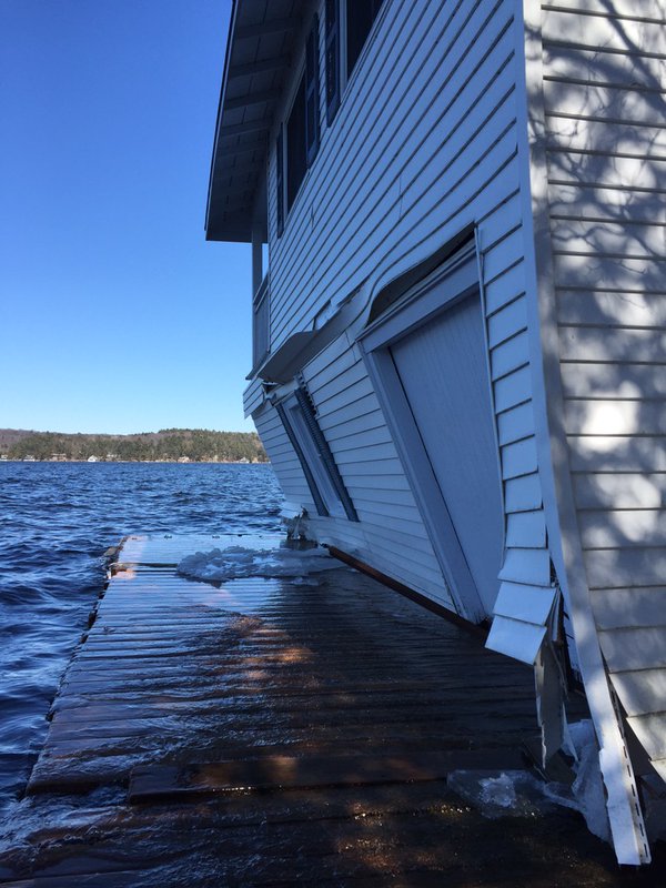
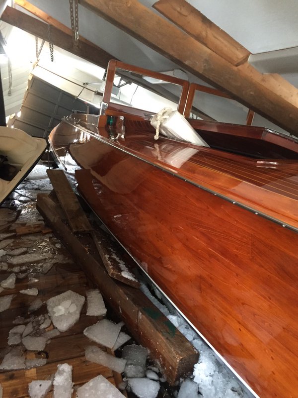
While property damage from the flood of 2013 consisted mainly of some damaged docks, shoreline erosion and lost personal property; this time there’s a horrible twist.
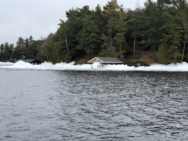
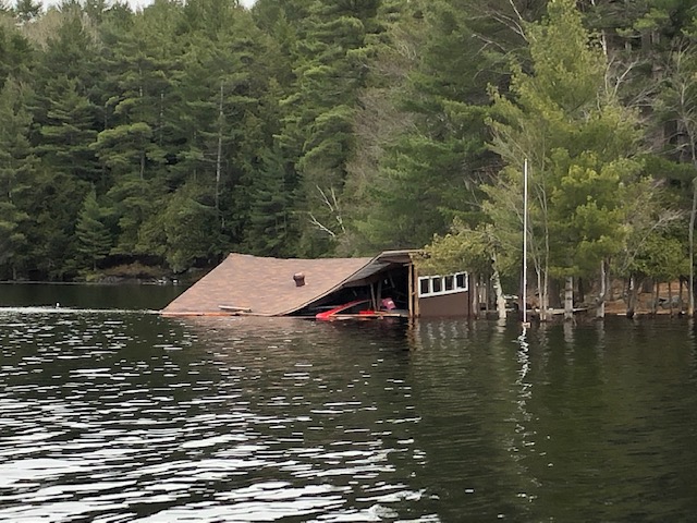
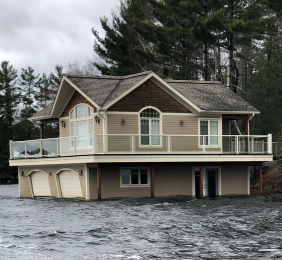
As the initial photos emerging on social media illustrate, ice sheets from breakup are sticking around due to colder than seasonal temperatures. When combined with high water levels and strong winds these ice sheets are taking a devastating toll on boathouses throughout the Muskoka Lakes. These examples are surely just the “tip of the iceberg” in terms of the true extent of property damage currently taking place and we expect more examples to emerge as people head north to check on their properties and open for spring.
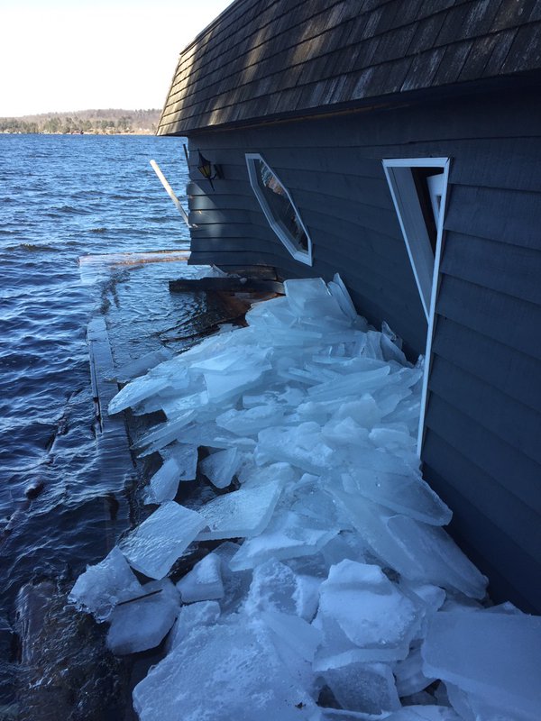
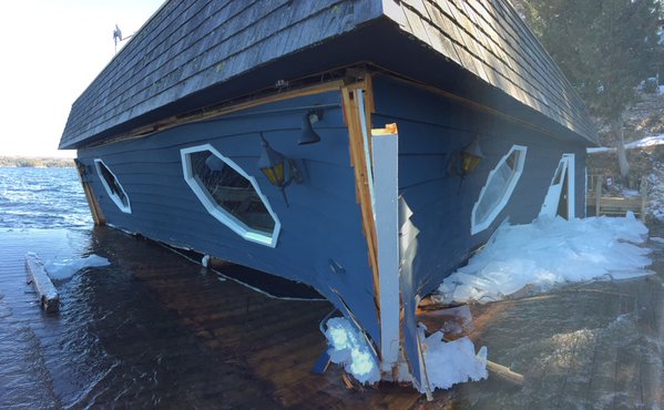
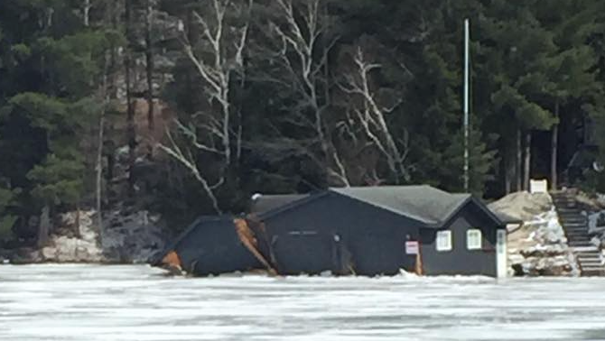
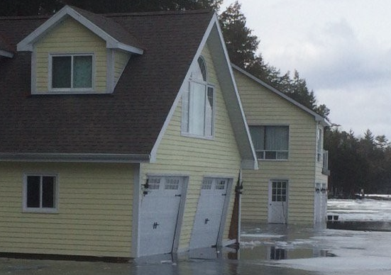
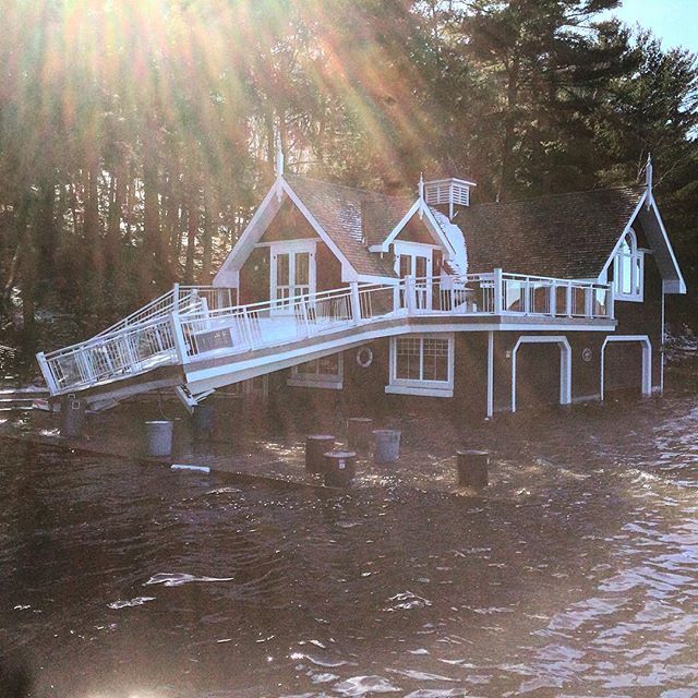
(photo credits: Chris McGlynn, Muskoka Crib Dock, Lane Robinson)
The root cause of this new spring “trend” remains a topic of contention. Some say mismanagement due to a lack of funding while others blame large scale environmental change (yikes!). Regardless, it is likely time that those responsible for the monitoring and management of the system properly address and communicate why these conditions are being experienced for the 4th straight season in a row when seasonal flooding previously was somewhat of an anomaly. If this is in fact expected to be the new norm, it would be settling to know that a plan of action is being prepared to attempt to curb the level of property damage currently being experienced. We bet property owners and insurance companies will be wanting some sort of explanation this go round.
The water management plan was changed in 2006 to benefit the power companies, as high water produces more electricity. Since 2006, there has been more high water damage than there was between 1940 and 2006 combined. Clearly this water management plan is failing property owners and businesses, but benefitting hydro one and its shareholders. The current water management plan expired March 31, 2016. Time to start sending damage bills to your government.
Seems to us the MNR scholars were asleep on their 9 to 5, five day a week jobs. Had they drawn Lake Muskoka down to a similar low level as 2015 it would have been 2ft lower this year before the spring run-off and rains arrived. That level would have easily handled the excess water flow. There needs to be an oversight body monitoring this gov’t incompetence.
the problem is the aggregrate industry is allowed to do whatever they want around here and there is no conservation authority here, if people care about their homes, their lives and their future they will lobby local counsel to get the conservation authority here before the next cliff is ripped down and sent south. Cliffs hold water, no cliff lots of water. But you know Brent sits on council, Fowler has more power than anyone, this is the problem, wake up before you are drowning in the water! This industry does no favours to this area, the employment they offer is shit and they take our resources and send them south.
the problem is the aggregrate industry is allowed to do whatever they want around here and there is no conservation authority here, if people care about their homes, their lives and their future they will lobby local counicillors to get the conservation authority here before the next cliff is ripped down and sent south. Cliffs hold water, not cliff lots of water. But you know Brent sits on council, Fowler has more power than anyone, this is the problem, wake up before you are drowning in the water!
Less giant boathouse s = less damage
The problem is, that the MNRF did not take note of Mother Nature’s cycles this year. We had steady precipitation, thaw process occurring all winter. And instead of being proactive, and demising that the spring run off was going to occur early. They followed the playbook to a ‘T’! starting the water drop as if it was a normal year. They need to pay attention to all that happens. Freeze / thaw. El Nino. La / Nina. The weather patterns that affect the whole world. Because they have a MAJOR affect on this region.